Thursday 30 October 2014

Improved piaware Reception

After running piaware on the RPi B+ for a few days I was reasonably pleased with the reception but wanted to have an antenna outdoors. It would have been a fairly difficult job to try waterproofing my home brew collinear so after a look round the web decided to order a TMRF-1090 from Taylor Made RF Ltd.

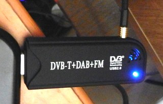
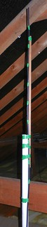
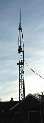
I fitted it to the top of my mast so it is just above the roof of my bungalow and connected it with Heliax half inch FSJ low loss coax which I had spare. The antenna is sturdily built and well finished. The simple instructions with it made it a doddle to fit together. The Heliax is very stiff so it goes as far as the entrance through the bungalow wall and then connects to RG213 the rest of the way with a short flexible link to the dongle.

DSCN3664     DSCN3663

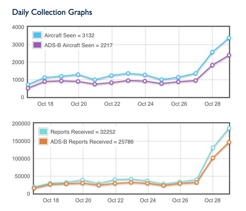
Once connected up it was a case of seeing how much reception would have changed. Would the TMRF-1090 be worth the time, effort and money? I needn't have worried as can be seen by the increase in the numbers of aircraft tracked in the statistics from FlightAware:

Data 2014-10-30

A little video of real time tracking using piaware with FlightAware on the Raspberry Pi B+:


Friday 17 October 2014

PiAware on a Raspberry Pi B+

Browsing the various RPi related tweets I follow I had a look at RasPi Weekly Issue 71. On there I saw a link which caught my attention. Some time ago I had software running on a PC which used a DVB dongle to collect aircraft position information and plot their positions in real time on a map. The link related to some software (PiAware) to do a similar sort of job using the Raspberry Pi and led to the Flight Aware site.

I still had my DAB dongle ...
 10316324615_33fc029e31_o     DSCN1909a
... connected to my home made collinear aerial in the roof space.
Details for making the aerial can be found on Radio Antics.

After downloading the software and fitting the dongle it didn't take too long to get the software working and sign up (free) to Flight Aware. This is needed as the RPi sends the signals it receives to their servers. Next a web browser is used to log in to the RPI and the information is plotted in real time on a map:


Clicking on an aircraft brings up information about speed and height on the right and a line shows the track it took while my system was able to receive the radio information.

I was hoping to be able to see the map on the RPi's own monitor. So far I haven't discovered how, or even if it's actually possible.